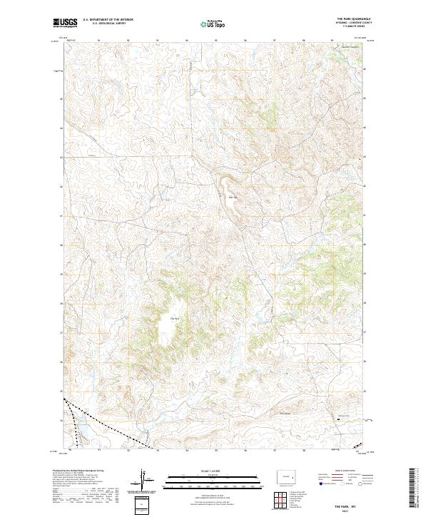
2021 Map of The Park
USGS Topo · Published 2021About this map
The Park name applies to this elevated interior landscape of Converse County, where the high plains are carved by an intricate drainage system feeding the Cheyenne River watershed. The terrain is defined by prominent landmarks such as Flat Top and the secluded Fero Draw in the southeastern corner. This area of Wyoming exhibits a traditional township-and-range land pattern, crisscrossed by rural routes like Wintermote Rd and Dickau Rd. For genealogists and local historians, the presence of the Shawnee Cem provides a specific point of interest for tracing early families in the region. The map reveals how water has shaped the land over time, from the winding path of Twentymile Cr in the north to the various branches of Shawnee Creek, including the Middle Fork Shawnee Cr and E Fork Shawnee Cr.
Find a feature on this map
23 named features on this map. Tap any name to fly to it.
Don’t see what you’re looking for? This feature index may not catch every label — zoom into the map to look around manually.
Map Details
Editions of this 2021 The Park Map
This is the sole edition of this map. No revisions or reprints were ever made.
Other maps of this area

1949 · Shawnee
USGS Topo · 1:24,000

1949 · Orin
USGS Topo · 1:24,000

1950 · Amend Ranch
USGS Topo · 1:24,000

1950 · Orin
USGS Topo · 1:24,000

1950 · Shawnee
USGS Topo · 1:24,000

1954 · Torrington
USGS Topo · 1:250,000

1958 · Torrington
USGS Topo · 1:250,000
1961 · Shawnee
USGS Topo · 1:24,000

1970 · Lost Springs
USGS Topo · 1:24,000
1970 · The Park
USGS Topo · 1:24,000