1973 Map of The Pines
USGS Topo · Published 1976About this map
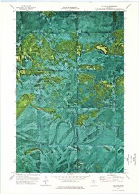
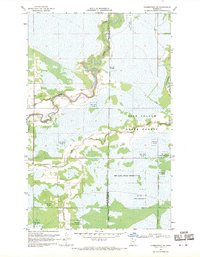
Pine Island State Forest and the Red Lake Indian Reservation define this landscape along the border of Lake of the Woods and Koochiching counties. Created as an orthophotomat using 1969 aerial photography, the map reveals a vast wetland and forest complex where the natural vegetation patterns are clearly visible beneath topographic contours. The absence of modern development is striking, with the primary means of traversal being a long, winding Winter Trail that snakes through the northwestern sections. This document captures the wilderness of northern Minnesota before extensive modern forest management altered the terrain, preserving the mid-century layout of these protected lands and the specific jurisdictional boundaries of the Red Lake Ind Res.
Find a feature on this map
5 named features on this map. Tap any name to fly to it.
Don’t see what you’re looking for? This feature index may not catch every label — zoom into the map to look around manually.
Map Details
Editions of this 1973 The Pines Map
This is the sole edition of this map. No revisions or reprints were ever made.
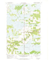
Other maps of this area
1919 · Knutson
USGS Topo · 1:62,500
1921 · Baudette
USGS Topo · 1:62,500

1954 · Roseau
USGS Topo · 1:250,000

1957 · Roseau
USGS Topo · 1:250,000

1958 · Roseau
USGS Topo · 1:250,000
1968 · Baudette SE
USGS Topo · 1:24,000
1968 · Clementson SW
USGS Topo · 1:24,000

1968 · Clementson SE
USGS Topo · 1:24,000

1973 · Ludlow Lookout Tower
USGS Topo · 1:24,000

1973 · Wayland SW
USGS Topo · 1:24,000