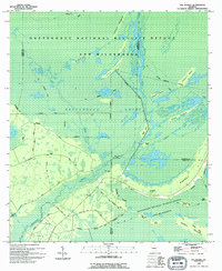
1994 Map of The Pocket
USGS Topo · Published 1994About this map
Okefenokee National Wildlife Refuge and Wilderness dominates this landscape, showing a complex network of wetlands and islands in the 1990s. The map centers on The Pocket, a distinctive interior peninsula bordered by the winding Suwannee River and Bay Creek. This area illustrates the balance between natural preservation and human history, where remote landforms like Bill Young Island, Macks Island, and Mixons Hammock rise above the surrounding Okefenokee Swamp.
Find a feature on this map
34 named features on this map. Tap any name to fly to it.
Don’t see what you’re looking for? This feature index may not catch every label — zoom into the map to look around manually.
Map Details
Editions of this 1994 The Pocket Map
This is the sole edition of this map. No revisions or reprints were ever made.
Other maps of this area

1954 · Valdosta
USGS Topo · 1:250,000

1958 · Valdosta
USGS Topo · 1:250,000

1959 · Valdosta
USGS Topo · 1:250,000

1965 · Blackjack Island
USGS Topo · 1:24,000

1965 · Dinner Pond
USGS Topo · 1:24,000
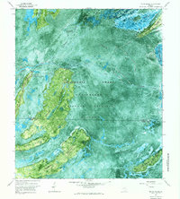
1966 · Billys Island
USGS Topo · 1:24,000

1966 · The Pocket
USGS Topo · 1:24,000

1966 · Cravens Island
USGS Topo · 1:24,000

1967 · Strange Island
USGS Topo · 1:24,000

1967 · Spooner
USGS Topo · 1:24,000