
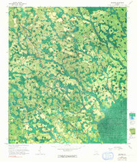
1967 Map of Spooner
USGS Topo · Published 1968About this map
The dense marshlands and blackwater drainages of the Okefenokee Swamp dominate this experimental 1960s study, which utilized a photogrammetric mosaic to record the complex hydrology of the Georgia interior. The landscape is characterized by a labyrinth of watercourses including Rooty Branch, Surveyors Creek, and Goose Branch that feed into the protected grounds of the Okefenokee National Wildlife Refuge. Small settlements and isolated landmarks provide critical human context among the wetlands, such as the Antioch Ch and the Lookout Tower near Spooner. The presence of the Dismal Logging Tram and the rail junction at The Wye near Jamestown highlights the historical timber industry and infrastructure required to navigate this saturated terrain. Notable landmasses like Gainey Island and Stevens Bay rise above the surrounding swamp, marking the divide where Ware Co meets Clinch Co.
Find a feature on this map
18 named features on this map. Tap any name to fly to it.
Don’t see what you’re looking for? This feature index may not catch every label — zoom into the map to look around manually.
Map Details
Editions of this 1967 Spooner Map
2 editions found
Other maps of this area

1953 · Waycross
USGS Topo · 1:250,000

1954 · Valdosta
USGS Topo · 1:250,000

1958 · Valdosta
USGS Topo · 1:250,000

1958 · Waycross
USGS Topo · 1:250,000

1959 · Valdosta
USGS Topo · 1:250,000

1966 · The Pocket
USGS Topo · 1:24,000

1966 · Cravens Island
USGS Topo · 1:24,000

1967 · Colon
USGS Topo · 1:24,000

1967 · Waycross SW
USGS Topo · 1:24,000

1968 · Homerville East
USGS Topo · 1:24,000