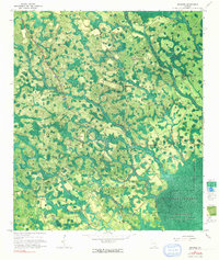
1967 Map of Spooner
USGS Topo · Published 1991About this map
Okefenokee Swamp and the dense blackwater drainage of the Okefenokee National Wildlife Refuge dominate this landscape on the Clinch and Ware county line. The map captures a transitional landscape of wet pine woods and marshy depressions, where human activity is defined by the extraction of timber. Evidence of former industry is found in the Dismantled Logging Tram paths that cut through the wetlands, and significant navigation points like The Wye and the Lookout Tower near Spooner. Small rural hubs such as Jamestown and the Antioch Ch provide social anchors in an area otherwise carved by an intricate network of named water bodies, including Surveyors Creek, RootY Branch, and Barnum Branch. The presence of landmarks like Gainey Island and Stevens Bay reflects the localized naming conventions used by those who worked the cypress and pine stands in the mid-20th century.
Find a feature on this map
22 named features on this map. Tap any name to fly to it.
Don’t see what you’re looking for? This feature index may not catch every label — zoom into the map to look around manually.
Map Details
Editions of this 1967 Spooner Map
2 editions found
Other maps of this area

1953 · Waycross
USGS Topo · 1:250,000

1954 · Valdosta
USGS Topo · 1:250,000

1958 · Valdosta
USGS Topo · 1:250,000

1958 · Waycross
USGS Topo · 1:250,000

1959 · Valdosta
USGS Topo · 1:250,000

1966 · The Pocket
USGS Topo · 1:24,000

1966 · Cravens Island
USGS Topo · 1:24,000

1967 · Spooner
USGS Topo · 1:24,000

1967 · Colon
USGS Topo · 1:24,000

1967 · Waycross SW
USGS Topo · 1:24,000