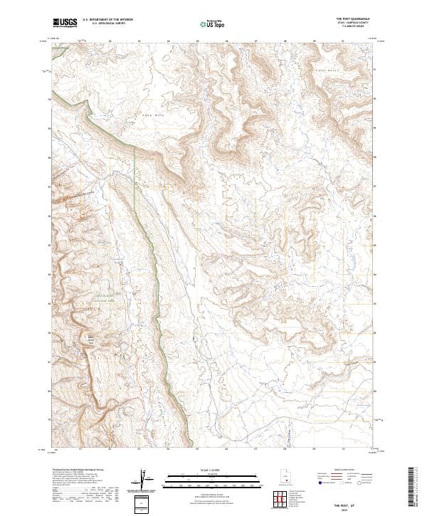
2023 Map of The Post
USGS Topo · Published 2023About this map
Capitol Reef National Park and its dramatic geologic formations dominate this portion of Garfield County. The massive Water Pocket Fold creates a natural barrier across the landscape, forcing the development of specific routes like the Lower Muley Cutoff Trl and Muley Twist Canyon. Water sources are critical identifiers in this arid terrain, with Willow Tanks, Cottonwood Tanks, and Muley Tanks serving as essential landmarks for navigation and survival. To the north, the elevation rises toward Swap Mesa and Cave Point, while the southern reaches are defined by deep incisions like Grand Gulch and Clay Canyon. This mapping shows how trail networks, including the Grand Gulch Route Trl, follow the natural drainage of Halls Creek to move through the complex topography of the reef.
Find a feature on this map
20 named features on this map. Tap any name to fly to it.
Don’t see what you’re looking for? This feature index may not catch every label — zoom into the map to look around manually.
Map Details
Editions of this 2023 The Post Map
This is the sole edition of this map. No revisions or reprints were ever made.
Other maps of this area

1886 · Escalante
USGS Topo · 1:250,000

1886 · Henry Mountains
USGS Topo · 1:250,000

1892 · Henry Mountains
USGS Topo · 1:250,000

1952 · Mt Pennell 2 NE
USGS Topo · 1:24,000

1953 · Mt Pennell
USGS Topo · 1:62,500

1953 · Circle Cliffs 1 SE
USGS Topo · 1:24,000

1953 · Mt Pennell 2 SE
USGS Topo · 1:24,000

1953 · Mt Pennell 3 NW
USGS Topo · 1:24,000
1953 · Circle Cliffs 1 NE
USGS Topo · 1:24,000

1953 · Mt Pennell 2 SW
USGS Topo · 1:24,000