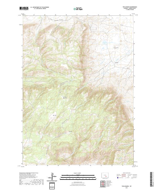
2021 Map of The Q Ranch
USGS Topo · Published 2021About this map
The Q Ranch serves as a primary landmark in this high-altitude Carbon County landscape, located where the Shirley Basin meets the eastern slopes of the Shirley Mountains. The area is defined by a complex drainage network, where seasonal and perennial waters such as Grinnell Cr, Quealy Cr, and Lisenby Cr carve through the terrain. A notable geological transition occurs near The Sinks, where surface water patterns shift significantly across the undulating topography. Further south, the prominent rise of Bald Mtn overlooks several drainages including Cottonwood Cr and Troublesome Cr. The network of backroads, including the Shirley Mountain Loop Rd and Prior Flat Rd, provides access to remote high-country features like Bear Park and Prior Flat, illustrating the enduring ranching and recreational utility of this Wyoming mountain range.
Find a feature on this map
34 named features on this map. Tap any name to fly to it.
Don’t see what you’re looking for? This feature index may not catch every label — zoom into the map to look around manually.
Map Details
Editions of this 2021 The Q Ranch Map
This is the sole edition of this map. No revisions or reprints were ever made.
Other maps of this area

1953 · Fourmile Point
USGS Topo · 1:24,000

1953 · Fourmile Ridge
USGS Topo · 1:24,000

1953 · Schneider Ridge
USGS Topo · 1:24,000

1953 · The Q Ranch
USGS Topo · 1:24,000

1953 · T E Ranch
USGS Topo · 1:24,000

1953 · Beaver Creek
USGS Topo · 1:24,000

1955 · Casper
USGS Topo · 1:250,000

1958 · Casper
USGS Topo · 1:250,000

1960 · Wild Irish Reservoir
USGS Topo · 1:24,000
1961 · Pine Hill
USGS Topo · 1:24,000