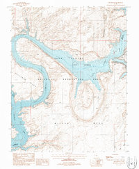
1987 Map of The Rincon
USGS Topo · Published 1988About this map
The Rincon dominates the landscape as a massive circular entrenched meander, a geologic formation that provides evidence of the ancient course of the Colorado River before it carved its present path. By the late 1980s, the rising waters of Lake Powell had flooded the deep gorges of Glen Canyon, transforming the canyon floor into a complex system of navigable waterways. This map details the intersection of this desert reservoir with dramatic landforms such as the Waterpocket Fold and Pollywog Bench.
Find a feature on this map
15 named features on this map. Tap any name to fly to it.
Don’t see what you’re looking for? This feature index may not catch every label — zoom into the map to look around manually.
Map Details
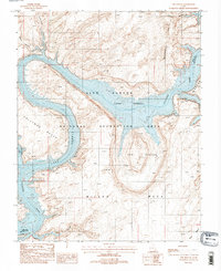
Editions of this 1987 The Rincon Map
2 editions found
Other maps of this area

1886 · Henry Mountains
USGS Topo · 1:250,000

1892 · Henry Mountains
USGS Topo · 1:250,000

1953 · Navajo Mountain 4 NW
USGS Topo · 1:24,000

1953 · The Rincon
USGS Topo · 1:62,500

1953 · Lake Canyon
USGS Topo · 1:62,500

1953 · Navajo Mountain
USGS Topo · 1:62,500

1953 · No Mans Mesa
USGS Topo · 1:62,500

1956 · Escalante
USGS Topo · 1:250,000

1960 · Escalante
USGS Topo · 1:250,000
1981 · Navajo Mountain
USGS Topo · 1:100,000