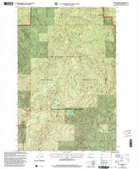
1998 Map of The Rockies
USGS Topo · Published 2003About this map
Mt Baker Snoqualmie National Forest dominates this landscape in Lewis County, where the high ridges of the Cascades create a complex drainage network. The terrain is defined by prominent peaks including Stahl Mountain, Ladd Mountain, and the namesake formation known as The Rockies. Waters flow from these heights into major systems like the Nisqually River and the upper reaches of the Deschutes River, with numerous smaller tributaries such as Scatter Creek and Wildcat Creek cutting through the steep slopes.
Find a feature on this map
26 named features on this map. Tap any name to fly to it.
Don’t see what you’re looking for? This feature index may not catch every label — zoom into the map to look around manually.
Map Details
Editions of this 1998 The Rockies Map
This is the sole edition of this map. No revisions or reprints were ever made.
Other maps of this area

1937 · Eatonville
USGS Topo · 1:125,000

1941 · Tanwax Lake
USGS Topo · 1:62,500

1944 · Ohop Valley
USGS Topo · 1:62,500

1949 · Ohop Valley
USGS Topo · 1:62,500

1953 · Hoquiam
USGS Topo · 1:250,000

1956 · Mineral
USGS Topo · 1:62,500

1956 · Kapowsin
USGS Topo · 1:62,500

1957 · Hoquiam
USGS Topo · 1:250,000

1957 · Morton
USGS Topo · 1:62,500

1958 · Hoquiam
USGS Topo · 1:250,000