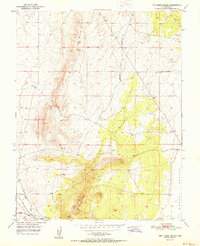
1951 Map of The Three Peaks
USGS Topo · Published 1951About this map
Iron Springs serves as the primary focal point of this 1951 survey, situated along the Union Pacific railroad line at the edge of the expansive Cedar Valley. The terrain is defined by dramatic geological formations, most notably the prominent cluster of The Three Peaks and the high ridges of The Bald Hills. To the west, the landscape drops away at the Hole in the Wall, a distinctive topographic break in the hills. The presence of several Prospects and a lone Windmill indicates the early industrial and agricultural efforts to tap into the region's mineral wealth and water resources. Drainage is managed by the seasonal courses of Iron Springs Creek and Horse Hollow, which cut through the arid landscape toward the valley floor, while Antelope Rd provides the primary overland connection through this mining and ranching corridor.
Find a feature on this map
15 named features on this map. Tap any name to fly to it.
Don’t see what you’re looking for? This feature index may not catch every label — zoom into the map to look around manually.
Map Details
Editions of this 1951 The Three Peaks Map
This is the sole edition of this map. No revisions or reprints were ever made.
Other maps of this area

1885 · St. George
USGS Topo · 1:250,000

1891 · St. George
USGS Topo · 1:250,000

1949 · Cedar City NW
USGS Topo · 1:24,000

1950 · Cedar City NW
USGS Topo · 1:24,000

1950 · Enoch
USGS Topo · 1:24,000

1950 · Cedar City
USGS Topo · 1:24,000

1950 · Enoch
USGS Topo · 1:62,500

1950 · Iron Mountain
USGS Topo · 1:62,500

1950 · Cedar City
USGS Topo · 1:62,500

1950 · The Three Peaks
USGS Topo · 1:24,000