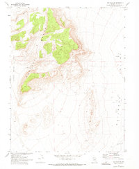
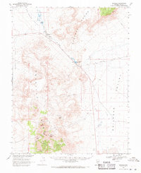
1968 Map of The Wall SW
USGS Topo · Published 1973About this map
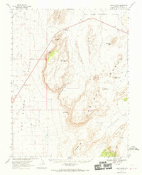
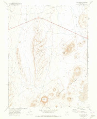
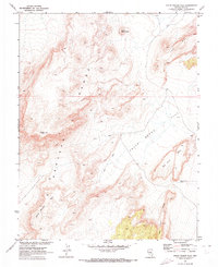
Railroad Valley dominates the eastern portion of this high-desert landscape, captured during a 1967 photogrammetric survey conducted in cooperation with the Atomic Energy Commission. The topography is defined by the dramatic convergence of The Wall Range and the Pancake Range, which separate the wide valley floor from Chuck Wagon Flat to the west. This mid-century survey reveals a sparse but essential network of water sources necessary for life in the Great Basin, notably Pigeon Well and Stone Corral Well. The presence of these named wells and a series of fence lines suggests the area’s continued use for livestock grazing, even as the broader region was being studied for its geological and atomic-era potential.
Find a feature on this map
6 named features on this map. Tap any name to fly to it.
Don’t see what you’re looking for? This feature index may not catch every label — zoom into the map to look around manually.
Map Details
Editions of this 1968 The Wall SW Map
This is the sole edition of this map. No revisions or reprints were ever made.
Other maps of this area

1956 · Lund
USGS Topo · 1:250,000

1956 · Tonopah
USGS Topo · 1:250,000

1959 · Tonopah
USGS Topo · 1:250,000

1960 · Lund
USGS Topo · 1:250,000

1962 · Tonopah
USGS Topo · 1:250,000
1967 · Lunar Crater
USGS Topo · 1:62,500
1967 · Lunar Crater
USGS Topo · 1:24,000
1967 · Chuck Wagon Flat
USGS Topo · 1:24,000
1968 · Reveille
USGS Topo · 1:62,500
1968 · The Wall
USGS Topo · 1:62,500