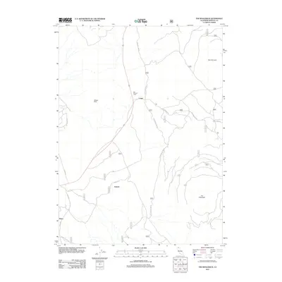
2012 Map of The Whaleback
USGS Topo · Published 2012About this map
Deer Mountain Lodge and the small settlement of Cougar serve as central points in this Siskiyou County landscape, situated where the high desert meets volcanic terrain. The topography is dominated by prominent landforms such as The Whaleback and Deer Mountain, while the western edge is marked by the distinctive Sheep Rock. The layout of the land reflects a history of resource management and early 21st-century infrastructure, with a complex network of forest access routes including the Grass Lake Fire Rd and Upper Cougar Fire Rd. To the south, the rail-and-road corridor near Andesite and Bolam highlights the area's logistical importance for timber and transport. This survey, compiled from 2010 imagery, captures a moment when traditional forest industry names like Bolam Logging Rd remained integrated into the modern geographic record.
Find a feature on this map
17 named features on this map. Tap any name to fly to it.
Don’t see what you’re looking for? This feature index may not catch every label — zoom into the map to look around manually.
Map Details
Editions of this 2012 The Whaleback Map
This is the sole edition of this map. No revisions or reprints were ever made.
Other maps of this area

1886 · Shasta
USGS Topo · 1:250,000

1894 · Shasta
USGS Topo · 1:250,000

1922 · Shasta Valley Sheet No 10 E
USGS Topo · 1:24,000

1934 · Macdoel
USGS Topo · 1:96,000

1935 · Dunsmuir
USGS Topo · 1:125,000

1941 · Macdoel
USGS Topo · 1:125,000

1948 · Weed
USGS Topo · 1:250,000

1950 · Weed
USGS Topo · 1:250,000

1954 · The Whaleback
USGS Topo · 1:62,500

1954 · Shasta
USGS Topo · 1:62,500