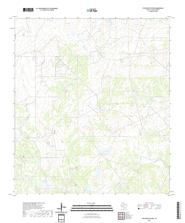
2022 Map of The White Kitchen
USGS Topo · Published 2022About this map
The water-scarce landscape of La Salle County is defined by a complex network of man-made reservoirs and seasonal drainages. Scattered across the brush country, these features underscore the infrastructure required for ranching in South Texas. Major livestock water sources include Salt Well Tank, Red Tank, and the notably named Maguey Tank, while larger impoundments like Walker Lake Number 3 and Walker Lake Number 1 appear in the southwestern corner. Intermittent watercourses such as Yeager Cr, Sauz Cr, and Piedra Cr carve paths through the terrain, though their flow is dictated by rare rain events. Human presence is sparse, centered on managed land divisions and the transit corridor provided by Ranch Rd 469 along the western edge. This survey documents the vital water-management names that anchor the local geography, from Fourteen Section Tank to the several Yeager-family tanks distributed across the northern half.
Find a feature on this map
22 named features on this map. Tap any name to fly to it.
Don’t see what you’re looking for? This feature index may not catch every label — zoom into the map to look around manually.
Map Details
Editions of this 2022 The White Kitchen Map
This is the sole edition of this map. No revisions or reprints were ever made.
Other maps of this area

1929 · Cotulla
USGS Topo · 1:125,000

1940 · Cotulla
USGS Topo · 1:62,500

1942 · Fowlerton
USGS Topo · 1:62,500

1953 · Crystal City
USGS Topo · 1:250,000

1955 · Crystal City
USGS Topo · 1:250,000

1956 · Piedra Creek
USGS Topo · 1:62,500

1956 · Fowlerton
USGS Topo · 1:62,500

1957 · Caiman Creek
USGS Topo · 1:62,500

1961 · Crystal City
USGS Topo · 1:250,000

1968 · Crystal City
USGS Topo · 1:250,000