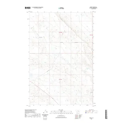
2020 Map of Thebes
USGS Topo · Published 2020About this map
Big Porcupine Rd and Cohagen Rd cross this part of Rosebud County, marking the sparse transit network of the high plains north of the Yellowstone River. The terrain is defined by the drainage patterns of Big Porcupine Cr and W Blacktail Cr, which carve into the landscape to form distinct coulees like Blind Coulee and Sun Coulee. While the map reflects the modern landscape as of 2020, the arterial naming of Petroleum Rd suggests the enduring influence of regional energy development on the local geography. This area is characterized by large township grids and open range, where topographic variations are primarily found along the edges of these water-carved depressions.
Find a feature on this map
10 named features on this map. Tap any name to fly to it.
Don’t see what you’re looking for? This feature index may not catch every label — zoom into the map to look around manually.
Map Details
Editions of this 2020 Thebes Map
This is the sole edition of this map. No revisions or reprints were ever made.
Other maps of this area

1954 · Forsyth
USGS Topo · 1:250,000

1957 · Forsyth
USGS Topo · 1:250,000

1958 · Forsyth
USGS Topo · 1:250,000

1960 · Steie Ranch
USGS Topo · 1:24,000

1960 · Hagen Ranch
USGS Topo · 1:24,000

1960 · Vananda
USGS Topo · 1:24,000

1960 · Ahles
USGS Topo · 1:24,000

1960 · Thebes
USGS Topo · 1:24,000

1960 · Ingomar East
USGS Topo · 1:24,000

1960 · Brown Coulee
USGS Topo · 1:24,000