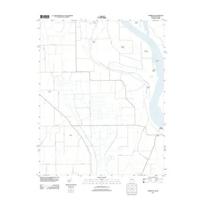
2012 Map of Thebes SW
USGS Topo · Published 2012About this map
The Mississippi River dominates the eastern boundary of this Missouri landscape, shaping a complex network of chutes and islands along the state line. Features like Goat Island, Powers Island, and the Anita Towhead illustrate the river's shifting nature and the navigational challenges of the alluvial floodplain. Further inland, the land is heavily modified by drainage infrastructure, most notably the North Cut Ditch, which channelizes water away from the agricultural flats. This survey provides significant genealogical value for Scott County researchers, identifying several rural burial grounds including Prince Cemetery in the north and Cason Cemetery further south. The small river-adjacent settlements of Lusk and Price Landing mark traditional access points to the water, while a dense grid of county roads, such as Co HWY-344 and Co HWY-506, connects the dispersed farmsteads across the low-lying terrain.
Find a feature on this map
36 named features on this map. Tap any name to fly to it.
Don’t see what you’re looking for? This feature index may not catch every label — zoom into the map to look around manually.
Map Details
Editions of this 2012 Thebes SW Map
This is the sole edition of this map. No revisions or reprints were ever made.
Other maps of this area

1931 · Sikeston
USGS Topo · 1:62,500

1934 · Thebes
USGS Topo · 1:62,500

1934 · Morley
USGS Topo · 1:62,500

1934 · Sikeston
USGS Topo · 1:62,500

1939 · Sikeston
USGS Topo · 1:62,500

1939 · Charleston
USGS Topo · 1:62,500

1939 · Morley
USGS Topo · 1:62,500

1939 · Thebes
USGS Topo · 1:62,500

1949 · Paducah
USGS Topo · 1:250,000

1950 · Paducah
USGS Topo · 1:250,000