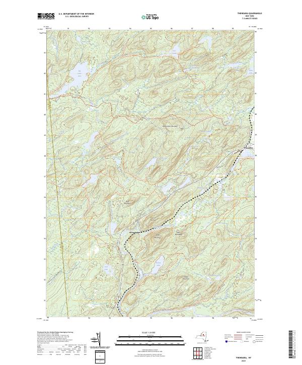
2023 Map of Thendara
USGS Topo · Published 2023About this map
The Adirondack wilderness of Herkimer County unfolds across this 2023 survey, centered on the historic settlements of Thendara and Minnehaha. The landscape is dominated by the complex hydrology of the Adirondack Park Preserve, where the Middle Branch Moose River and South Branch Moose River carve through a terrain defined by peaks like Moose River Mountain and Flatrock Mountain. This modern map reveals a dense network of recreational corridors and historic passages, including the Browns Tract Trl and Big Otter Lake Trl, which connect numerous water bodies such as Big Otter Lake and Lake Tekeni. The proximity of Lewis Co and Herkimer Co boundaries highlights the regional importance of the area for both conservation and timber history. Genealogists and historians can trace the evolution of access via Old Rte 28 and the extensive trail system that reaches secluded spots like Nelson Lake and Gull Lake.
Find a feature on this map
66 named features on this map. Tap any name to fly to it.
Don’t see what you’re looking for? This feature index may not catch every label — zoom into the map to look around manually.
Map Details
Editions of this 2023 Thendara Map
This is the sole edition of this map. No revisions or reprints were ever made.
Other maps of this area

1901 · Old Forge
USGS Topo · 1:62,500

1903 · Big Moose
USGS Topo · 1:62,500

1912 · Number Four
USGS Topo · 1:62,500

1912 · Mc Keever
USGS Topo · 1:62,500

1915 · Number Four
USGS Topo · 1:62,500

1950 · Utica
USGS Topo · 1:250,000

1954 · Old Forge
USGS Topo · 1:62,500

1954 · Big Moose
USGS Topo · 1:62,500

1957 · Utica
USGS Topo · 1:250,000
1957 · Number Four
USGS Topo · 1:62,500