
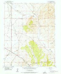
1958 Map of Thermo
USGS Topo · Published 1960About this map
The Union Pacific railroad cuts a straight line through the Escalante Desert in this mid-century survey, anchoring the small settlement of Thermo. The landscape transition is stark, shifting from the flat, arid plains of the desert to the complex topography of the Black Mountains. This high country is marked by numerous peaks and valleys, including Badger Peak and Horse Valley, which are dotted with water sources essential for livestock or early travel, such as Hot Springs Canyon Pond and Baboon Seep.
Find a feature on this map
39 named features on this map. Tap any name to fly to it.
Don’t see what you’re looking for? This feature index may not catch every label — zoom into the map to look around manually.
Map Details
Editions of this 1958 Thermo Map
This is the sole edition of this map. No revisions or reprints were ever made.
Other maps of this area

1885 · St. George
USGS Topo · 1:250,000

1885 · Beaver
USGS Topo · 1:250,000

1886 · Kanab
USGS Topo · 1:250,000

1891 · St. George
USGS Topo · 1:250,000

1950 · Enoch
USGS Topo · 1:62,500

1950 · Enoch NE
USGS Topo · 1:24,000

1951 · Avon
USGS Topo · 1:24,000
1952 · Enoch NW
USGS Topo · 1:24,000

1952 · Enoch NE
USGS Topo · 1:24,000

1953 · Ninemile Knoll
USGS Topo · 1:24,000