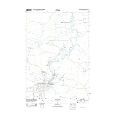
2012 Map of Thermopolis
USGS Topo · Published 2012About this map
The Bighorn River carves a deep path through this landscape, defining the layout of Thermopolis and its neighbor, East Thermopolis. This area is renowned for its geothermal activity, clearly documented through features such as Thermopolis Hot Springs, the Devils Punch Bowl, and Big Spring. The map captures the complex irrigation and water management system essential to the region, including the South Side Ditch, Kirby Ditch, and Covey Slough.
Find a feature on this map
80 named features on this map. Tap any name to fly to it.
Don’t see what you’re looking for? This feature index may not catch every label — zoom into the map to look around manually.
Map Details
Editions of this 2012 Thermopolis Map
This is the sole edition of this map. No revisions or reprints were ever made.
Other maps of this area

1914 · Blue Mesa
USGS Topo · 1:62,500

1916 · Blue Mesa
USGS Topo · 1:62,500

1945 · Kirby
USGS Topo · 1:62,500

1946 · Kirby
USGS Topo · 1:62,500

1955 · Thermopolis
USGS Topo · 1:250,000

1958 · Thermopolis
USGS Topo · 1:250,000

1960 · Devil Slide
USGS Topo · 1:24,000

1960 · Red Hole
USGS Topo · 1:24,000
1960 · Wedding Of The Waters
USGS Topo · 1:24,000

1960 · Thermopolis
USGS Topo · 1:24,000