
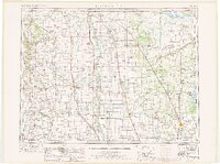
1952 Map of Thief River Falls
USGS Topo · Published 1967About this map
Thief River Falls and the surrounding Red River Valley are depicted here as they appeared following the mid-century, detailing a landscape defined by its international border and extensive wetland conservation. The map highlights the complex hydrologic network of the Red River of the North, including the Tamarac River, Snake River, and the Pembina River as it flows from the Pembina Mountains. This region is a critical corridor for transport and wildlife preservation, evidenced by the numerous state game refuges and the expansive Agassiz National Wildlife Refuge.
Find a feature on this map
147 named features on this map. Tap any name to fly to it.
Don’t see what you’re looking for? This feature index may not catch every label — zoom into the map to look around manually.
Map Details
Editions of this 1952 Thief River Falls Map
2 editions found
Other maps of this area

1918 · Hemmington
USGS Topo · 1:62,500

1918 · Rollis
USGS Topo · 1:62,500

1918 · Angus
USGS Topo · 1:62,500

1918 · Walhalla
USGS Topo · 1:62,500

1918 · Terrebonne
USGS Topo · 1:62,500

1918 · Roseau
USGS Topo · 1:62,500

1918 · Acton
USGS Topo · 1:62,500

1918 · Garland
USGS Topo · 1:62,500

1918 · Red Lake Falls
USGS Topo · 1:62,500

1918 · Argyle
USGS Topo · 1:62,500