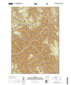
2020 Map of Thimbleberry Mountain
USGS Topo · Published 2020About this map
Umatilla National Forest encompasses this high-elevation landscape, where a dense network of ridges and drainages defines the geography. High points like Thimbleberry Mtn and Huckleberry Mtn dominate the central terrain, while Goodman Ridge and McDonald Ridge extend across the northern reaches. The area is characterized by an intricate water system, including the S Fork Umatilla River and various named springs such as Bear Camp Spring and Dead-Horse Spring, which likely served as critical water sources for forest travelers and early sheep or cattle drives.
Find a feature on this map
46 named features on this map. Tap any name to fly to it.
Don’t see what you’re looking for? This feature index may not catch every label — zoom into the map to look around manually.
Map Details
Editions of this 2020 Thimbleberry Mountain Map
This is the sole edition of this map. No revisions or reprints were ever made.
Other maps of this area

1953 · Pendleton
USGS Topo · 1:250,000

1956 · Pendleton
USGS Topo · 1:250,000

1963 · Andies Prairie
USGS Topo · 1:24,000

1963 · Sanderson Spring
USGS Topo · 1:24,000

1963 · Bingham Springs
USGS Topo · 1:24,000

1963 · Summerville
USGS Topo · 1:24,000

1964 · Duncan
USGS Topo · 1:24,000

1964 · Thimbleberry Mtn
USGS Topo · 1:24,000

1964 · Gibbon
USGS Topo · 1:24,000

1964 · Huron
USGS Topo · 1:24,000