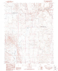
1986 Map of Thirsty Canyon SW
USGS Topo · Published 1986About this map
Oasis Valley defines the landscape of this southern Nevada desert, where the subterranean waters of the Amargosa River occasionally surface in a string of vital springs. This 1986 revision, based on earlier surveys dating back to 1964, documents a rugged basin dominated by drainage systems like Thirsty Canyon and Rocket Wash. Significant portions of the eastern and northern territory are designated as a Restricted Access Area within the Nellis Air Force Range, illustrating the Cold War-era military footprint on the American West. Beyond the military boundaries, the map reveals traces of mineral exploration, specifically marking several Prospects and a Mine Shaft, alongside isolated water features such as Colson Pond. These features highlight the dual history of the region as both a site for high-security federal operations and a challenging environment for traditional prospectors.
Find a feature on this map
15 named features on this map. Tap any name to fly to it.
Don’t see what you’re looking for? This feature index may not catch every label — zoom into the map to look around manually.
Map Details
Editions of this 1986 Thirsty Canyon SW Map
This is the sole edition of this map. No revisions or reprints were ever made.
Other maps of this area

1908 · Kawich
USGS Topo · 1:250,000

1908 · Furnace Creek
USGS Topo · 1:250,000

1910 · Furnace Creek
USGS Topo · 1:250,000

1942 · Tolicha Peak
USGS Topo · 1:125,000

1942 · Bullfrog
USGS Topo · 1:125,000

1948 · Death Valley
USGS Topo · 1:250,000

1954 · Bare Mtn
USGS Topo · 1:62,500

1954 · Bullfrog
USGS Topo · 1:62,500

1954 · Death Valley
USGS Topo · 1:250,000

1954 · Goldfield
USGS Topo · 1:250,000