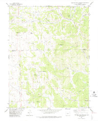
1983 Map of Thirtyone Mile Mountain
USGS Topo · Published 1983About this map
The high-country divide of the Park Co Fremont Co border dominates this 1983 topographic study, centered on the massive prominence of Thirtyone Mile Mountain. The landscape is a complex network of high peaks and drainage basins, where Thirtyone Mile Creek and Currant Creek cut through the terrain. Numerous small-scale mining efforts are evident across the slopes, marked simply as Prospect or Prospects, indicating the region's enduring draw for mineral exploration. Significant landforms like East Antelope Mountain, West Antelope Mountain, and Wall Mountain provide clear landmarks for the high-altitude topography. A remote infrastructure of Jeep Trails provides the primary access through these mountains, linking isolated points such as Yellow Soda Spring and several family-named gulches, reflecting a rugged environment largely defined by its natural features rather than permanent settlements.
Find a feature on this map
24 named features on this map. Tap any name to fly to it.
Don’t see what you’re looking for? This feature index may not catch every label — zoom into the map to look around manually.
Map Details
Editions of this 1983 Thirtyone Mile Mountain Map
2 editions found
Other maps of this area

1894 · Pikes Peak
USGS Topo · 1:125,000

1901 · Pikes Peak
USGS Topo · 1:125,000

1942 · Cover Mtn.
USGS Topo · 1:62,500

1948 · Cover Mtn.
USGS Topo · 1:62,500

1954 · Pueblo
USGS Topo · 1:250,000

1957 · Pueblo
USGS Topo · 1:250,000

1958 · Pueblo
USGS Topo · 1:250,000

1959 · Black Mountain
USGS Topo · 1:62,500

1959 · Guffey
USGS Topo · 1:62,500
1959 · Florissant
USGS Topo · 1:62,500