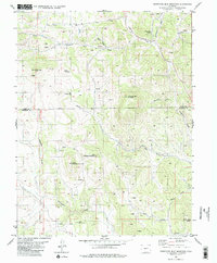
1983 Map of Thirtyone Mile Mountain
USGS Topo · Published 1983About this map
Thirtyone Mile Mountain and the surrounding high country of central Colorado define this 1983 topographic study, which captures the terrain at the border of Park and Fremont counties. The landscape is marked by a network of drainage features such as Currant Creek and Freshwater Creek, interspersed with numerous peaks including East Antelope Mountain and West Antelope Mountain. Of particular interest to local historians are the scattered prospects found throughout the gulches, indicating a legacy of resource exploration. Distinctive landmarks like Yellow Soda Spring and the steep elevations of Delilah Peak and Hammond Peak provide a detailed look at the geographic character of this region before modern development further altered the backcountry. The map also traces various unnamed trails and jeep roads that wind through the valleys of Paris Creek and Meadow Gulch, illustrating the accessibility of these high-altitude ranges in the late 20th century.
Find a feature on this map
21 named features on this map. Tap any name to fly to it.
Don’t see what you’re looking for? This feature index may not catch every label — zoom into the map to look around manually.
Map Details
Editions of this 1983 Thirtyone Mile Mountain Map
2 editions found
Other maps of this area

1894 · Pikes Peak
USGS Topo · 1:125,000

1901 · Pikes Peak
USGS Topo · 1:125,000

1942 · Cover Mtn.
USGS Topo · 1:62,500

1948 · Cover Mtn.
USGS Topo · 1:62,500

1954 · Pueblo
USGS Topo · 1:250,000

1957 · Pueblo
USGS Topo · 1:250,000

1958 · Pueblo
USGS Topo · 1:250,000

1959 · Black Mountain
USGS Topo · 1:62,500

1959 · Guffey
USGS Topo · 1:62,500
1959 · Florissant
USGS Topo · 1:62,500