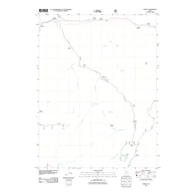
2011 Map of Thistle
USGS Topo · Published 2011About this map
Thistle and the surrounding canyon country are defined by the convergence of Soldier Creek and Lake Fork, where narrow drainage corridors dictate the path of infrastructure. In this 2011 survey, the Thistle Substation and the winding course of Lake Fork Rd trace the rugged topography of the Spanish Fork Canyon area. The landscape is characterized by a high density of named springs and hollows, such as Chicken Hollow, Coal Hollow, and Buggy Wheel Spring, which highlight the vital role of water sources in this arid Utah environment. To the east, The Red Narrows marks a dramatic geological constriction along the creek, while the southern portion of the quadrangle features Smiths Reservoir and Smiths Dam. This map serves as a detailed record of local nomenclature, from the high point at Sky High to the depths of Side Canyon and Rock Canyon.
Find a feature on this map
38 named features on this map. Tap any name to fly to it.
Don’t see what you’re looking for? This feature index may not catch every label — zoom into the map to look around manually.
Map Details
Editions of this 2011 Thistle Map
This is the sole edition of this map. No revisions or reprints were ever made.
Other maps of this area

1885 · Salt Lake
USGS Topo · 1:250,000

1885 · Manti
USGS Topo · 1:250,000

1895 · Manti
USGS Topo · 1:250,000

1907 · Strawberry Valley
USGS Topo · 1:125,000

1909 · Strawberry Valley
USGS Topo · 1:125,000

1949 · Provo
USGS Topo · 1:62,500

1949 · Spanish Fork Peak
USGS Topo · 1:24,000

1951 · Spanish Fork Peak
USGS Topo · 1:24,000

1952 · Santaquin Peak
USGS Topo · 1:62,500

1954 · Salt Lake City
USGS Topo · 1:250,000