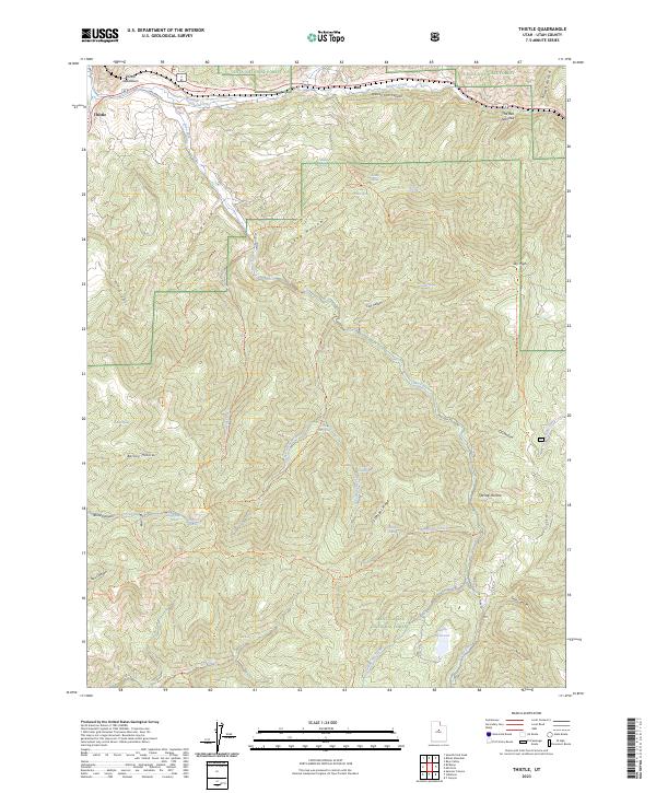
2023 Map of Thistle
USGS Topo · Published 2023About this map
Thistle sits at a critical junction in Spanish Fork Canyon, where the Rio Grande railroad line follows the course of Soldier Creek through a landscape of deep canyons and high ridges. The area is defined by its transition between the Uinta National Forest to the north and the Manti-La Sal National Forest to the south. This modern survey reflects the complex drainage systems of the region, marked by numerous named springs such as Sky High Spring and Buggy Wheel Spring, which feed into the Lake Fork and its various tributaries. The terrain is notably etched by erosion, featuring landmarks like The Red Narrows and Coffeepot Ridge. While industrial footprints are few, the Thistle Substation and Smiths Reservoir indicate the ongoing human management of resources in this mountainous Utah corridor. Old trails like the Dipping Pen Trl and Sky High Trl provide a look at the historical routes used to navigate these high-elevation valleys.
Find a feature on this map
47 named features on this map. Tap any name to fly to it.
Don’t see what you’re looking for? This feature index may not catch every label — zoom into the map to look around manually.
Map Details
Editions of this 2023 Thistle Map
This is the sole edition of this map. No revisions or reprints were ever made.
Other maps of this area

1885 · Salt Lake
USGS Topo · 1:250,000

1885 · Manti
USGS Topo · 1:250,000

1895 · Manti
USGS Topo · 1:250,000

1907 · Strawberry Valley
USGS Topo · 1:125,000

1909 · Strawberry Valley
USGS Topo · 1:125,000

1949 · Provo
USGS Topo · 1:62,500

1949 · Spanish Fork Peak
USGS Topo · 1:24,000

1951 · Spanish Fork Peak
USGS Topo · 1:24,000

1952 · Santaquin Peak
USGS Topo · 1:62,500

1954 · Salt Lake City
USGS Topo · 1:250,000