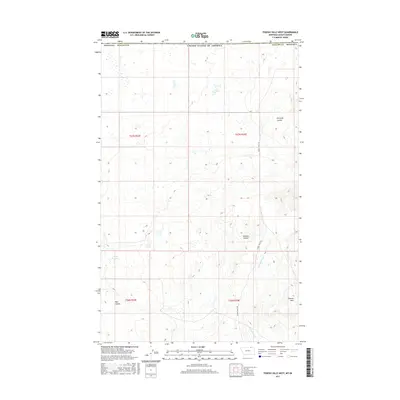
2017 Map of Thoeny Hills West
USGS Topo · Published 2017About this map
Thoeny Hills and the surrounding drainage basins of northeastern Phillips County define this high plains landscape just south of the international boundary. The terrain is characterized by a series of significant coulees, including Kennedy Coulee, Dunham Coulee, and Voje Coulee, which channel seasonal runoff toward larger watercourses. Water management is central to the area's utility, evidenced by the Grag Reservoir and the winding path of Cottonwood Cr. The survey illustrates a sparsely populated region primarily organized by the Public Land Survey System, with township lines for T37N and T36N marking the cadastral framework. Access through this remote Montana territory is facilitated by the aptly named Turkey Track Rd, which traverses the eastern sections of the quadrangle.
Find a feature on this map
14 named features on this map. Tap any name to fly to it.
Don’t see what you’re looking for? This feature index may not catch every label — zoom into the map to look around manually.
Map Details
Editions of this 2017 Thoeny Hills West Map
This is the sole edition of this map. No revisions or reprints were ever made.
Other maps of this area
1920 · Cowan
USGS Topo · 1:125,000

1954 · Glasgow
USGS Topo · 1:250,000

1957 · Glasgow
USGS Topo · 1:250,000

1958 · Glasgow
USGS Topo · 1:250,000
1984 · Thoeny Hills East
USGS Topo · 1:24,000
1984 · Pea Lake
USGS Topo · 1:24,000
1984 · Whitewater East
USGS Topo · 1:24,000
1984 · Dead Horse Coulee
USGS Topo · 1:24,000
1984 · Thoeny Hills West
USGS Topo · 1:24,000
1984 · Salsbery Reservoir
USGS Topo · 1:24,000