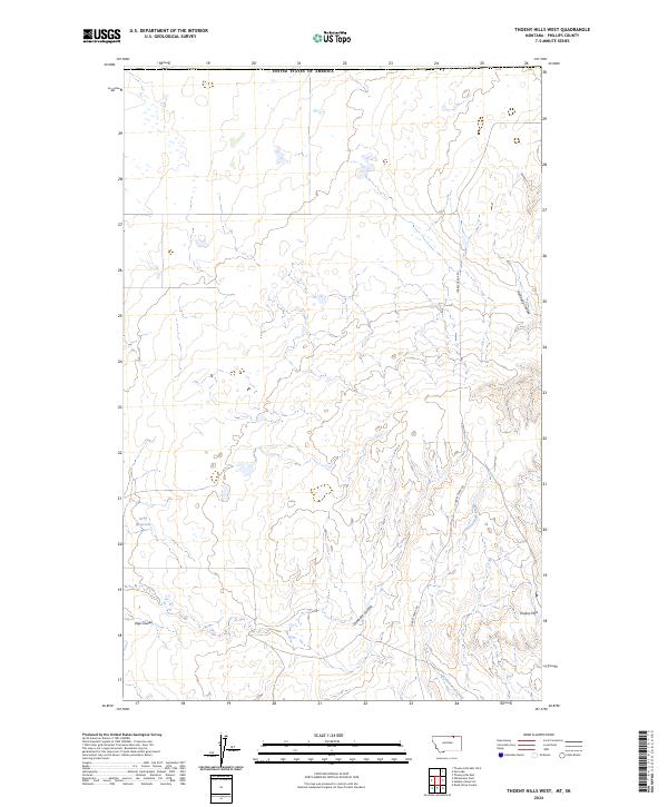
2024 Map of Thoeny Hills West
USGS Topo · Published 2024About this map
Thoeny Hills and the surrounding drainage basins of Phillips County define this section of the northern Montana plains. The landscape is carved by several distinct coulees, including Kennedy Coulee, Voje Coulee, and Dunham Coulee, which channel seasonal water toward Cottonwood Creek. The presence of the Grag Reservoir highlights the critical role of water management in this arid ranching country. Transportation is dominated by the long north-south corridor of Turkey Track Rd, reflecting the large-scale land divisions and open-range character of the region. Bordered to the north by the United States boundary, the map details a sparsely populated area where the topography is primarily shaped by natural erosion and isolated reservoirs rather than dense settlement.
Find a feature on this map
12 named features on this map. Tap any name to fly to it.
Don’t see what you’re looking for? This feature index may not catch every label — zoom into the map to look around manually.
Map Details
Editions of this 2024 Thoeny Hills West Map
This is the sole edition of this map. No revisions or reprints were ever made.
Other maps of this area

1920 · Cowan
USGS Topo · 1:125,000

1954 · Glasgow
USGS Topo · 1:250,000

1957 · Glasgow
USGS Topo · 1:250,000

1958 · Glasgow
USGS Topo · 1:250,000

1984 · Thoeny Hills East
USGS Topo · 1:24,000

1984 · Pea Lake
USGS Topo · 1:24,000

1984 · Whitewater East
USGS Topo · 1:24,000

1984 · Dead Horse Coulee
USGS Topo · 1:24,000
1984 · Thoeny Hills West
USGS Topo · 1:24,000
1984 · Salsbery Reservoir
USGS Topo · 1:24,000