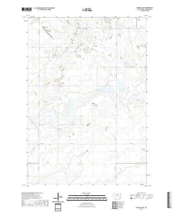
2021 Map of Thomas Lake
USGS Topo · Published 2021About this map
Medicine Knoll Creek and Medicine Creek meander through this portion of Hyde County, defining a landscape marked by scattered glacial lakes and prairie depressions. This topographic study captures the rural character of the region, where section lines and county roads such as Co RD 648 and Co RD 645 provide the primary framework for the local agricultural community. Small-scale landmarks like Gary Myers Airport and the Spring Lake Cem serve as important touchpoints for local history and genealogy. The presence of Thomas Lake and the nearby Spring Lake highlight the characteristic hydrology of the South Dakota plains, where water bodies often dictate the layout of township and range boundaries like t116n r73w and t116n r72w.
Find a feature on this map
22 named features on this map. Tap any name to fly to it.
Don’t see what you’re looking for? This feature index may not catch every label — zoom into the map to look around manually.
Map Details
Editions of this 2021 Thomas Lake Map
This is the sole edition of this map. No revisions or reprints were ever made.
Other maps of this area

1949 · Mitchell Lake
USGS Topo · 1:24,000

1950 · Mitchell Lake
USGS Topo · 1:24,000

1951 · Rice Lake
USGS Topo · 1:24,000

1951 · Rezac Lake NW
USGS Topo · 1:24,000

1953 · Huron
USGS Topo · 1:250,000

1954 · Huron
USGS Topo · 1:250,000

1968 · Harrold NW
USGS Topo · 1:24,000

1968 · Harrold NE
USGS Topo · 1:24,000
1978 · Bald Hills
USGS Topo · 1:24,000
1978 · Thomas Lake
USGS Topo · 1:24,000