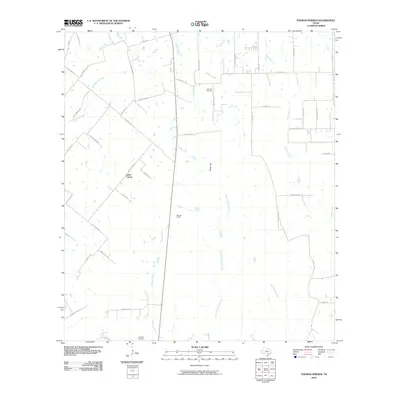
2010 Map of Thomas Springs
USGS Topo · Published 2010About this map
Jakes Colony serves as a primary settlement point in this rural landscape of south-central Texas, where agricultural tracts are divided by an intricate network of local roads and creek drainage basins. The area's history is anchored by sites like Zion Hill Cemetery near Krams Creek and Neyland Cemetery further south, providing important touchpoints for genealogical research. The terrain is defined by low rises such as Kings Hill and Deer Ridge, which overlook the headwaters of several regional waterways.
Find a feature on this map
53 named features on this map. Tap any name to fly to it.
Don’t see what you’re looking for? This feature index may not catch every label — zoom into the map to look around manually.
Map Details
Editions of this 2010 Thomas Springs Map
This is the sole edition of this map. No revisions or reprints were ever made.
Other maps of this area

1911 · San Marcos
USGS Topo · 1:125,000

1919 · San Marcos
USGS Topo · 1:125,000

1920 · Smiley
USGS Topo · 1:125,000

1924 · New Braunfels No 4
USGS Topo · 1:48,000

1924 · San Marcos 3-c
USGS Topo · 1:48,000

1924 · San Marcos 3-d
USGS Topo · 1:48,000

1927 · New Braunfels
USGS Topo · 1:62,500

1930 · Seguin
USGS Topo · 1:62,500

1942 · Dewville
USGS Topo · 1:62,500

1953 · Seguin
USGS Topo · 1:250,000