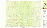
1981 Map of Thomaston
USGS Topo · Published 1981About this map
Thomaston and Connorville serve as central nodes in this Western Upper Peninsula landscape, situated within the expansive Ottawa National Forest. The region's industrial and natural heritage is defined by the Presque Isle River, which winds through the terrain past landmarks like Minnewawa Falls and Ninnikon Falls. The Soo Line railroad bisects the southern portion of the area, providing a transit corridor alongside older infrastructure like the Old RR Grade and the Jack Spur.
Find a feature on this map
52 named features on this map. Tap any name to fly to it.
Don’t see what you’re looking for? This feature index may not catch every label — zoom into the map to look around manually.
Map Details
Editions of this 1981 Thomaston Map
This is the sole edition of this map. No revisions or reprints were ever made.
Other maps of this area

1943 · Ironwood
USGS Topo · 1:48,000

1953 · Ashland
USGS Topo · 1:250,000

1955 · Marenisco
USGS Topo · 1:62,500

1955 · Marenisco
USGS Topo · 1:24,000

1955 · Bessemer
USGS Topo · 1:24,000

1955 · Wakefield
USGS Topo · 1:24,000

1955 · Wakefield
USGS Topo · 1:62,500

1955 · Wakefield NE
USGS Topo · 1:24,000

1955 · Ironwood
USGS Topo · 1:62,500

1956 · North Ironwood
USGS Topo · 1:62,500