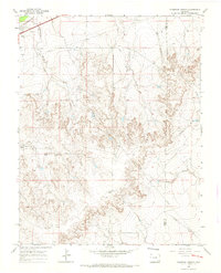
1966 Map of Thompson Arroyo
USGS Topo · Published 1970About this map
Thompson Arroyo and a series of rugged watercourses carve through the southeastern Colorado high plains along the boundary of Otero and Bent Counties. This 1960s landscape is defined by its drainage systems, featuring the Vandiver Arroyo, Robinson Arroyo, and the East Fork of the King Arroyo. Human activity in this arid environment is focused near the northern corner, where a Drive-in Theater and a Gravel Pit appear alongside a prominent Pipeline. Further south, the terrain rises toward Miller Mesa, where Circle I Waters Spring provides a rare named water source amidst the canyons. This map offers a detailed view of the regional ranching and transport infrastructure before modern consolidation, marked by landmarks like a Radio Tower and the deep winding path of Mixon Canyon.
Find a feature on this map
14 named features on this map. Tap any name to fly to it.
Don’t see what you’re looking for? This feature index may not catch every label — zoom into the map to look around manually.
Map Details
Editions of this 1966 Thompson Arroyo Map
2 editions found
Other maps of this area

1891 · Catlin
USGS Topo · 1:125,000

1891 · Higbee
USGS Topo · 1:125,000

1891 · Las Animas
USGS Topo · 1:125,000

1891 · Timpas
USGS Topo · 1:125,000

1893 · Higbee
USGS Topo · 1:125,000

1893 · Las Animas
USGS Topo · 1:125,000

1893 · Catlin
USGS Topo · 1:125,000

1894 · Timpas
USGS Topo · 1:125,000

1953 · Cheraw
USGS Topo · 1:24,000

1953 · Cornelia
USGS Topo · 1:24,000