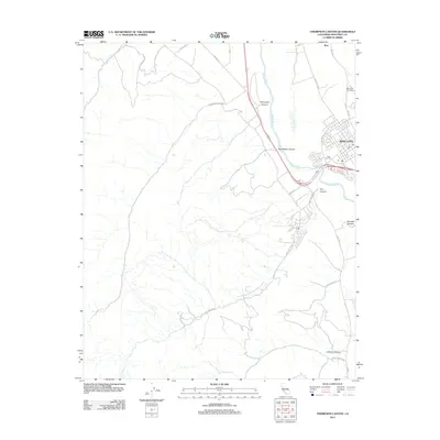
2012 Map of Thompson Canyon
USGS Topo · Published 2012About this map
The Salinas River valley serves as the central artery for this portion of Monterey County, anchoring the urban center of King City and the nearby agricultural siding of Elsa. The map illustrates a landscape defined by the stark contrast between the alluvial floor and the complex drainage networks of the surrounding hills, where numerous deep-cut ravines such as Thompson Canyon, Branstetter Canyon, and Pine Canyon descend toward the river. Local infrastructure is concentrated in the east, featuring the Mesa Del Rey Airport and a developed grid of streets including Metz Rd and San Antonio Dr. Genealogists and local historians can locate the King City Cem situated just outside the main town, while the southern reaches of the quadrangle are marked by more remote terrain and features like Quinado Canyon and Cherry Canyon.
Find a feature on this map
27 named features on this map. Tap any name to fly to it.
Don’t see what you’re looking for? This feature index may not catch every label — zoom into the map to look around manually.
Map Details
Editions of this 2012 Thompson Canyon Map
This is the sole edition of this map. No revisions or reprints were ever made.
Other maps of this area

1912 · Metz
USGS Topo · 1:31,680

1915 · Soledad
USGS Topo · 1:62,500

1919 · King City
USGS Topo · 1:62,500

1919 · Junipero Serra
USGS Topo · 1:62,500

1921 · Metz
USGS Topo · 1:62,500

1939 · King City
USGS Topo · 1:62,500

1940 · Metz
USGS Topo · 1:62,500

1940 · Soledad
USGS Topo · 1:62,500

1941 · Junipero Serra
USGS Topo · 1:62,500

1947 · Metz
USGS Topo · 1:62,500