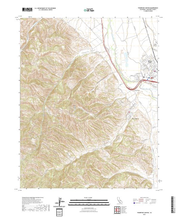
2021 Map of Thompson Canyon
USGS Topo · Published 2021About this map
King City serves as the focal point for this section of the Salinas Valley, where the Salinas River meets the San Lorenzo Creek. The map documents the residential and agricultural layout of the town, including the King City Cem and the Mesa Del Rey Airport to the northeast. To the west, the terrain rises sharply into the eastern foothills of the Santa Lucia Range, where a series of drainage systems like Thompson Canyon, Monroe Canyon, and Branstetter Canyon define the landscape.
Find a feature on this map
67 named features on this map. Tap any name to fly to it.
Don’t see what you’re looking for? This feature index may not catch every label — zoom into the map to look around manually.
Map Details
Editions of this 2021 Thompson Canyon Map
This is the sole edition of this map. No revisions or reprints were ever made.
Other maps of this area

1912 · Metz
USGS Topo · 1:31,680

1915 · Soledad
USGS Topo · 1:62,500

1919 · King City
USGS Topo · 1:62,500

1919 · Junipero Serra
USGS Topo · 1:62,500

1921 · Metz
USGS Topo · 1:62,500

1939 · King City
USGS Topo · 1:62,500

1940 · Metz
USGS Topo · 1:62,500

1940 · Soledad
USGS Topo · 1:62,500

1941 · Junipero Serra
USGS Topo · 1:62,500

1947 · Metz
USGS Topo · 1:62,500