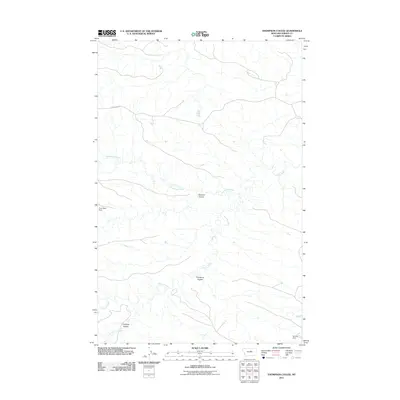
2011 Map of Thompson Coulee
USGS Topo · Published 2011About this map
Armells Creek meanders through this portion of Fergus County, defining a landscape of deep drainage channels and intermittent water sources. The terrain is characterized by significant coulees that score the earth, including the eponymous Thompson Coulee and Sawmill Coulee in the central portion of the sheet, and Antelope Coulee to the south. Human imprint on this rural environment is sparse, centered primarily around livestock and water management as evidenced by features like Poor Sport Dam and Murray Dam. The primary corridor for travel through this area is Knox Ridge Rd, which traverses the northern reaches above Sourdough Creek. This survey captures the specialized ranching geography of central Montana, where named topographic depressions and small-scale dams are the primary landmarks for navigation and land use.
Find a feature on this map
9 named features on this map. Tap any name to fly to it.
Don’t see what you’re looking for? This feature index may not catch every label — zoom into the map to look around manually.
Map Details
Editions of this 2011 Thompson Coulee Map
This is the sole edition of this map. No revisions or reprints were ever made.
Other maps of this area

1943 · Landusky
USGS Topo · 1:125,000

1954 · Baker Monument
USGS Topo · 1:24,000

1954 · Grand Island
USGS Topo · 1:24,000

1954 · Lewistown
USGS Topo · 1:250,000

1959 · Lewistown
USGS Topo · 1:250,000

1978 · Lewistown
USGS Topo · 1:100,000

1984 · Zortman
USGS Topo · 1:100,000

1985 · Griffee Coulee
USGS Topo · 1:24,000

1985 · Thompson Coulee
USGS Topo · 1:24,000
1985 · Mitchell Crossing
USGS Topo · 1:24,000