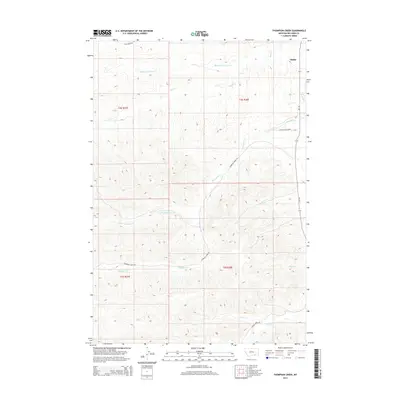
2014 Map of Thompson Creek
USGS Topo · Published 2014About this map
The community of Busby anchors this eastern Montana landscape, situated near the confluence where Rosebud Cr meets the local drainage network. The terrain is defined by a dense system of seasonal and perennial waterways, including Thompson Cr and the Middle Fork Davis Cr, which have carved intricate coulees and ridges across the region. These natural features dictate the path of local infrastructure, such as Davis Creek Rd and Thompson Creek Rd, which follow the valley floors between rising slopes.
Find a feature on this map
19 named features on this map. Tap any name to fly to it.
Don’t see what you’re looking for? This feature index may not catch every label — zoom into the map to look around manually.
Map Details
Editions of this 2014 Thompson Creek Map
This is the sole edition of this map. No revisions or reprints were ever made.
Other maps of this area

1894 · Rosebud
USGS Topo · 1:125,000

1901 · Rosebud
USGS Topo · 1:125,000

1954 · Hardin
USGS Topo · 1:250,000

1957 · Hardin
USGS Topo · 1:250,000

1958 · Hardin
USGS Topo · 1:250,000

1958 · Busby
USGS Topo · 1:24,000

1958 · Birdseye Spring
USGS Topo · 1:24,000

1967 · Wolf Mountain Lookout
USGS Topo · 1:24,000

1967 · Kirby
USGS Topo · 1:24,000
1967 · Jeans Fork SE
USGS Topo · 1:24,000