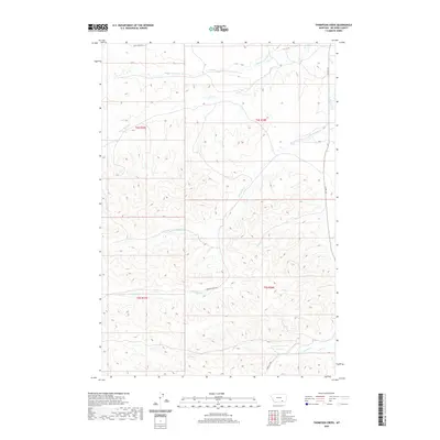
2020 Map of Thompson Creek
USGS Topo · Published 2020About this map
The high drainage basins of the Busby District define this landscape, where the headwaters of numerous creeks carve deep through the Big Horn County terrain. A network of ranch roads, including Reno Creek Rd and Thompson Crk Rd, follows the natural contours and valley floors between ridges. The hydrological patterns show a complex system of seasonal flows, notably Thompson Creek and its tributary Little Thompson Creek, which originate within the complex topography of Township 4 South and Township 5 South. To the east, County Road 314 skirts the edge of the Rosebud Creek drainage. This 2020 survey documents a ranching landscape where local geography is tied directly to the named watercourses such as Wolf Creek, Pine Creek, and Corral Creek.
Find a feature on this map
17 named features on this map. Tap any name to fly to it.
Don’t see what you’re looking for? This feature index may not catch every label — zoom into the map to look around manually.
Map Details
Editions of this 2020 Thompson Creek Map
This is the sole edition of this map. No revisions or reprints were ever made.
Other maps of this area

1894 · Rosebud
USGS Topo · 1:125,000

1901 · Rosebud
USGS Topo · 1:125,000

1954 · Hardin
USGS Topo · 1:250,000

1957 · Hardin
USGS Topo · 1:250,000

1958 · Hardin
USGS Topo · 1:250,000

1958 · Busby
USGS Topo · 1:24,000

1958 · Birdseye Spring
USGS Topo · 1:24,000

1967 · Wolf Mountain Lookout
USGS Topo · 1:24,000

1967 · Kirby
USGS Topo · 1:24,000
1967 · Jeans Fork SE
USGS Topo · 1:24,000