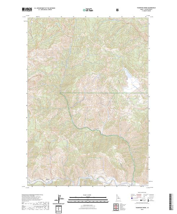
2024 Map of Thompson Creek
USGS Topo · Published 2024About this map
The Salmon River carves through the southern portion of this landscape, serving as a primary corridor for travel and settlement in Custer County. Near the river's edge, the small settlement of Torreys sits at the junction of several important mountain routes, including Robinson Bar Rd and Slate Creek Rd. This area is defined by the significant elevation changes of the Challis National Forest, where a network of trails like the Fivemile Creek Trl and Peach-Cinnabar Trl provides access to the high backcountry.
Find a feature on this map
27 named features on this map. Tap any name to fly to it.
Don’t see what you’re looking for? This feature index may not catch every label — zoom into the map to look around manually.
Map Details
Editions of this 2024 Thompson Creek Map
This is the sole edition of this map. No revisions or reprints were ever made.
Other maps of this area

1919 · Custer
USGS Topo · 1:125,000

1922 · Custer
USGS Topo · 1:125,000

1929 · Bayhorse
USGS Topo · 1:125,000

1957 · Challis
USGS Topo · 1:250,000

1960 · Challis
USGS Topo · 1:250,000

1963 · Challis
USGS Topo · 1:250,000

1963 · Custer
USGS Topo · 1:24,000

1963 · Bayhorse Lake
USGS Topo · 1:24,000
1963 · Elevenmile Creek
USGS Topo · 1:24,000

1963 · Clayton
USGS Topo · 1:24,000