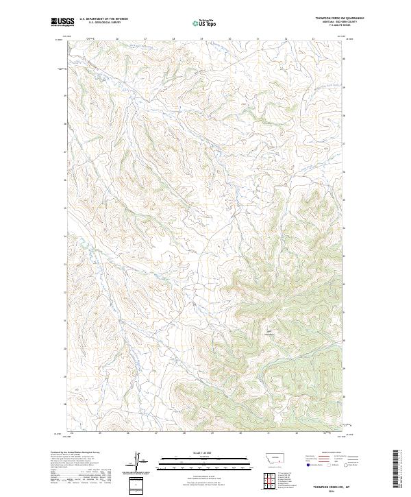
2024 Map of Thompson Creek NW
USGS Topo · Published 2024About this map
The Wolf Mountains dominate the southeastern portion of this landscape in Big Horn County, Montana, where the terrain breaks into a complex system of drainage headwaters. This area is defined by the diverging paths of major local waterways, with Reno Creek and its branches, including the North Fork Reno Creek and South Fork Reno Creek, flowing through the northwestern sections. To the east, the topography transitions toward the Davis Creek drainage system, including the Middle Fork Davis Creek. The presence of Reno Creek Rd and Su Rd indicates the primary corridors for land access in this cattle-country environment. The naming of Dipping Vat Creek in the north offers a direct reference to the region's ranching heritage, while Thompson Creek cuts through the southern reaches, illustrating the critical role of these seasonal and perennial water sources in high-plains geography.
Find a feature on this map
14 named features on this map. Tap any name to fly to it.
Don’t see what you’re looking for? This feature index may not catch every label — zoom into the map to look around manually.
Map Details
Editions of this 2024 Thompson Creek NW Map
This is the sole edition of this map. No revisions or reprints were ever made.
Other maps of this area

1894 · Rosebud
USGS Topo · 1:125,000

1901 · Rosebud
USGS Topo · 1:125,000

1954 · Hardin
USGS Topo · 1:250,000

1957 · Hardin
USGS Topo · 1:250,000

1958 · Hardin
USGS Topo · 1:250,000

1967 · Crow Agency SE
USGS Topo · 1:24,000

1967 · Lodge Grass NE
USGS Topo · 1:24,000

1967 · Wolf Mountain Lookout
USGS Topo · 1:24,000
1967 · Jeans Fork SE
USGS Topo · 1:24,000
1967 · Thompson Creek
USGS Topo · 1:24,000