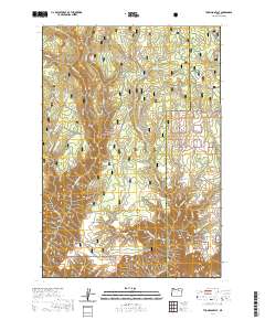
2020 Map of Thompson Flat
USGS Topo · Published 2020About this map
The Umatilla National Forest encompasses the majority of this landscape in eastern Oregon, where the boundary between Morrow and Umatilla counties cuts through a series of high-elevation drainages. The topography is defined by the steep descent of Potamus Cr and Thompson Cr, creating a rugged verticality that isolates high points like Potamus Point. These deep canyons provide a stark contrast to the higher, level reaches of Thompson Flat and Buckaroo Flat.
Find a feature on this map
39 named features on this map. Tap any name to fly to it.
Don’t see what you’re looking for? This feature index may not catch every label — zoom into the map to look around manually.
Map Details
Editions of this 2020 Thompson Flat Map
This is the sole edition of this map. No revisions or reprints were ever made.
Other maps of this area

1950 · Ritter
USGS Topo · 1:62,500

1951 · Monument
USGS Topo · 1:62,500

1952 · Ritter
USGS Topo · 1:62,500

1953 · Pendleton
USGS Topo · 1:250,000

1955 · Canyon City
USGS Topo · 1:250,000

1956 · Pendleton
USGS Topo · 1:250,000

1959 · Canyon City
USGS Topo · 1:250,000

1969 · Lake Penland
USGS Topo · 1:24,000

1969 · Sugarbowl Creek
USGS Topo · 1:24,000

1969 · Deerhorn Creek
USGS Topo · 1:24,000