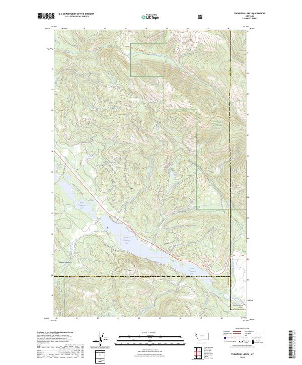
2024 Map of Thompson Lakes
USGS Topo · Published 2024About this map
Upper Thompson Lake, Middle Thompson Lake, and Lower Thompson Lake form a significant chain of water bodies along the corridor where Lincoln, Flathead, and Sanders counties meet. This mountain landscape is heavily dominated by the Kootenai National Forest, with terrain reaching high points like Bowers Peak and the eastern fringes of the Cabinet Mountains. The drainage network is complex, featuring Barnum Creek in the north and the Thompson River in the southeast, fed by tributaries such as Tallulah Creek and Slimmer Creek. This 2024 survey documents the modern infrastructure of the region, showing a network of forest development roads and the Campbell Ranch Airport near the southeastern corner. It provides a contemporary view of the intersection of timber management and recreation in northwestern Montana, where local roads like Metcalf Rd and Meadow Rd provide access to smaller water bodies like Rainbow Lake and Eli Lake.
Find a feature on this map
39 named features on this map. Tap any name to fly to it.
Don’t see what you’re looking for? This feature index may not catch every label — zoom into the map to look around manually.
Map Details
Editions of this 2024 Thompson Lakes Map
This is the sole edition of this map. No revisions or reprints were ever made.
Other maps of this area

1920 · Jennings
USGS Topo · 1:125,000

1935 · Thompson Lakes
USGS Topo · 1:96,000

1937 · Thompson Falls
USGS Topo · 1:125,000

1942 · Thompson Lakes
USGS Topo · 1:125,000

1956 · Wallace
USGS Topo · 1:250,000

1957 · Kalispell
USGS Topo · 1:250,000

1960 · Kalispell
USGS Topo · 1:250,000

1960 · Wallace
USGS Topo · 1:250,000

1961 · Kalispell
USGS Topo · 1:250,000

1964 · Meadow Peak
USGS Topo · 1:24,000