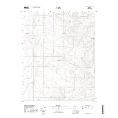
2020 Map of Thompson Mesa
USGS Topo · Published 2020About this map
Blanco Canyon and its associated Blanco Wash define the primary drainage system of this high-desert landscape in the Eastern Navajo Agency. This part of the San Juan Basin is characterized by sharp elevation changes between the canyon floors and the expansive plateau of Thompson Mesa, which rises in the eastern portion of the quadrangle. The land is sparsely developed, with the terrain marked by geological landmarks such as Blanco Mesa and the prominent Dufers Point. The map details the transition between San Juan and Rio Arriba counties, where the county line runs north-south across the high ground. Human impact is visible through a network of secondary routes including Co Rd 7425 and Co Rd 7575, which provide access through the complex network of side drainages like Selph Canyon.
Find a feature on this map
16 named features on this map. Tap any name to fly to it.
Don’t see what you’re looking for? This feature index may not catch every label — zoom into the map to look around manually.
Map Details
Editions of this 2020 Thompson Mesa Map
This is the sole edition of this map. No revisions or reprints were ever made.
Other maps of this area

1889 · Largo
USGS Topo · 1:250,000

1895 · Largo
USGS Topo · 1:250,000

1954 · Aztec
USGS Topo · 1:250,000

1958 · Aztec
USGS Topo · 1:250,000

1959 · Gould Pass
USGS Topo · 1:62,500

1959 · Nageezi
USGS Topo · 1:62,500

1960 · Bloomfield
USGS Topo · 1:62,500

1962 · Aztec
USGS Topo · 1:250,000

1965 · Aztec
USGS Topo · 1:250,000
1966 · Blanco Trading Post
USGS Topo · 1:24,000