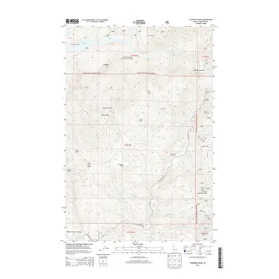
2013 Map of Thompson Point
USGS Topo · Published 2013About this map
Clearwater National Forest dominates this interior Idaho landscape, where the North Fork Clearwater River feeds into the expansive Dworshak Reservoir. The terrain is characterized by a series of high points and navigational breaks, including Thompson Point, Swan Point, and the Sheep Mountain Range. Along the water's edge, small access points like Isabella Landing and Butte Creek Landing reflect the area's history as a timber and recreational corridor. Forest travel is anchored by the Beaver Creek Rd, which winds through steep drainages like Sourdough Cr and Charlie Cr. High-elevation landmarks such as Kauffman Saddle and Beaver Butte served as essential orientation marks for forestry workers and hunters navigating the dense woods south of Salmon Ridge.
Find a feature on this map
55 named features on this map. Tap any name to fly to it.
Don’t see what you’re looking for? This feature index may not catch every label — zoom into the map to look around manually.
Map Details
Editions of this 2013 Thompson Point Map
This is the sole edition of this map. No revisions or reprints were ever made.
Other maps of this area

1923 · Washington Creek
USGS Topo · 1:125,000

1936 · Boehls Butte
USGS Topo · 1:48,000

1938 · Headquarters
USGS Topo · 1:48,000

1943 · Boehls Butte
USGS Topo · 1:62,500

1944 · Headquarters
USGS Topo · 1:62,500

1956 · Hamilton
USGS Topo · 1:250,000

1959 · Hamilton
USGS Topo · 1:250,000

1960 · Hamilton
USGS Topo · 1:250,000
1963 · Mallard Peak
USGS Topo · 1:24,000

1963 · Sheep Mtn
USGS Topo · 1:24,000