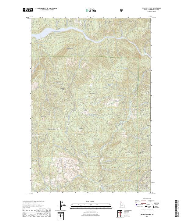
2024 Map of Thompson Point
USGS Topo · Published 2024About this map
Dworshak Reservoir dominates the northern landscape where the North Fork Clearwater River winds through the Idaho backcountry. This terrain is defined by a series of named high points and saddles that reveal the local nomenclature of the region, including Thompson Point, Swan Point, and Beaver Butte. The drainage network is dense, with numerous tributaries such as Marquette Creek, Isabella Creek, and Steep Creek feeding into the river system.
Find a feature on this map
49 named features on this map. Tap any name to fly to it.
Don’t see what you’re looking for? This feature index may not catch every label — zoom into the map to look around manually.
Map Details
Editions of this 2024 Thompson Point Map
This is the sole edition of this map. No revisions or reprints were ever made.
Other maps of this area

1923 · Washington Creek
USGS Topo · 1:125,000

1936 · Boehls Butte
USGS Topo · 1:48,000

1938 · Headquarters
USGS Topo · 1:48,000

1943 · Boehls Butte
USGS Topo · 1:62,500

1944 · Headquarters
USGS Topo · 1:62,500

1956 · Hamilton
USGS Topo · 1:250,000

1959 · Hamilton
USGS Topo · 1:250,000

1960 · Hamilton
USGS Topo · 1:250,000
1963 · Mallard Peak
USGS Topo · 1:24,000

1963 · Sheep Mtn
USGS Topo · 1:24,000