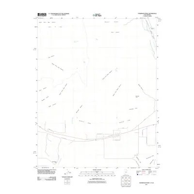
2011 Map of Thompson Point
USGS Topo · Published 2011About this map
The dramatic escarpments of the Vermilion Cliffs and Shinarump Cliffs dominate this portion of Kane County, Utah, just north of the Arizona border. This landscape is defined by its complex drainage systems, where Hog Canyon, Pugh Canyon, and Willis Canyon carve deep recesses into the high desert plateaus. The placement of Hog Canyon Spring, Ram Spring, and Toms Spring indicates the critical role of water sources in this arid environment, supporting small-scale habitation such as the Robinson Ranch near the mouth of Johnson Canyon. Settlement patterns are concentrated along the southern corridor, where modern roads like Red Cliffs Dr and E Vermillion Ave parallel the historical route of Old US Hwy 89. This transition zone between the high elevations of Wygaret Terrace and the low basins of Lost Spring Wash illustrates the geological layering and land-use history of the region.
Find a feature on this map
41 named features on this map. Tap any name to fly to it.
Don’t see what you’re looking for? This feature index may not catch every label — zoom into the map to look around manually.
Map Details
Editions of this 2011 Thompson Point Map
This is the sole edition of this map. No revisions or reprints were ever made.
Other maps of this area

1886 · Kanab
USGS Topo · 1:250,000

1886 · Kaibab
USGS Topo · 1:250,000

1953 · Cedar City
USGS Topo · 1:250,000

1953 · Grand Canyon
USGS Topo · 1:250,000

1954 · Johnson SE
USGS Topo · 1:24,000

1954 · Johnson NE
USGS Topo · 1:24,000

1954 · Kanab SE
USGS Topo · 1:24,000

1954 · Shinarump NW
USGS Topo · 1:24,000

1954 · Johnson SW
USGS Topo · 1:24,000

1954 · Fredonia NE
USGS Topo · 1:24,000