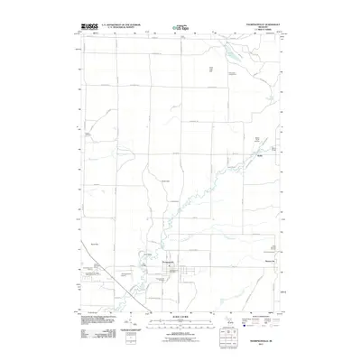
2011 Map of Thompsonville
USGS Topo · Published 2011About this map
Thompsonville serves as the central hub of this northern Michigan landscape, situated at the confluence of the Betsie River and its tributary, the Little Betsie River. The area is characterized by its agricultural grid and recreational destinations, including the Crystal Mountain Ski Area and the Crystal Mountain Betsie Valley Golf Course in the southwest. Beyond the main village, several smaller settlements and named locales like Wallin, Nessen City, and Carter Corners are joined by a network of rural roads such as Cinder Rd and S Thompsonville Hwy. Genealogists will find several burial grounds noted, including Weldon Cemetery and the Colfax Township Cemetery. Physical landmarks like Turtle Lake Hill and the North Hills provide topographic variety to the surrounding river valleys and plains.
Find a feature on this map
81 named features on this map. Tap any name to fly to it.
Don’t see what you’re looking for? This feature index may not catch every label — zoom into the map to look around manually.
Map Details
Editions of this 2011 Thompsonville Map
This is the sole edition of this map. No revisions or reprints were ever made.
Other maps of this area

1954 · Traverse City
USGS Topo · 1:250,000

1954 · Manitowoc
USGS Topo · 1:250,000

1956 · Onekama
USGS Topo · 1:62,500

1956 · Thompsonville
USGS Topo · 1:62,500

1956 · Frankfort
USGS Topo · 1:62,500

1957 · Copemish
USGS Topo · 1:62,500

1958 · Traverse City
USGS Topo · 1:250,000

1958 · Manitowoc
USGS Topo · 1:250,000

1976 · Thompsonville NE
USGS Topo · 1:24,000

1976 · Frankfort SE
USGS Topo · 1:24,000