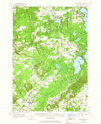
1956 Map of Thompsonville
USGS Topo · Published 1966About this map
The Chesapeake and Ohio railway corridors anchor the settlement patterns of central Michigan in the mid-1950s, connecting small communities like Thompsonville and Bendon. The landscape is a mix of agricultural clearings and dense woods, where the transition from pioneer-era infrastructure to modern recreation is evident. Educational and social foundations are represented by the Almira Sch and Homestead Ch, while signs of change appear at the Pleasant Grove Sch (Abandoned).
Find a feature on this map
101 named features on this map. Tap any name to fly to it.
Don’t see what you’re looking for? This feature index may not catch every label — zoom into the map to look around manually.
Map Details
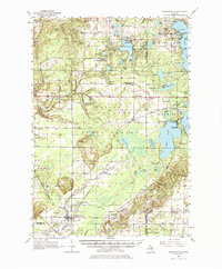
Editions of this 1956 Thompsonville Map
3 editions found
Other maps of this area

1954 · Traverse City
USGS Topo · 1:250,000

1954 · Manitowoc
USGS Topo · 1:250,000

1956 · Onekama
USGS Topo · 1:62,500

1956 · Kingsley
USGS Topo · 1:62,500

1956 · Mesick
USGS Topo · 1:62,500

1956 · Thompsonville
USGS Topo · 1:62,500

1956 · Frankfort
USGS Topo · 1:62,500

1957 · Traverse City
USGS Topo · 1:62,500

1957 · Empire
USGS Topo · 1:62,500

1957 · Copemish
USGS Topo · 1:62,500
Featured Places
- Long Lake Township, MI
- Long Lake Charter Township, Long Lake Township
- Green Lake Township, MI
- Grant Township, MI
- Interlochen, Green Lake Township