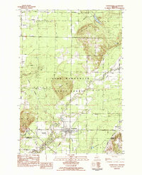
1983 Map of Thompsonville
USGS Topo · Published 1984About this map
The Betsie River and its tributary, the Little Betsie River, define the rural landscape of this Benzie and Manistee County borderland. Much of the central terrain is occupied by the Pere Marquette State Forest, which encompasses the North Hills. The village of Thompsonville serves as the primary hub, surrounded by smaller, scattered settlements like Nessen City, Wallin, and Carter Corners. This survey highlights a traditional agricultural and forestry-based economy, with numerous rural schools and community landmarks such as Homestead Ch and the Homestead Cem. The presence of the Thompsonville Landing Strip and specific river crossings like Black Bridge and Wallin Bridge show the local transportation network bridging the swampy lowlands around Dutchman Cr and Dair Creek. Geologists and researchers will note the transition from the upland Turtle Lake Hill near Turtle Lake to the river valleys that carve through Weldon and Colfax townships.
Find a feature on this map
35 named features on this map. Tap any name to fly to it.
Don’t see what you’re looking for? This feature index may not catch every label — zoom into the map to look around manually.
Map Details
Editions of this 1983 Thompsonville Map
This is the sole edition of this map. No revisions or reprints were ever made.
Other maps of this area

1954 · Traverse City
USGS Topo · 1:250,000

1954 · Manitowoc
USGS Topo · 1:250,000

1956 · Onekama
USGS Topo · 1:62,500

1956 · Thompsonville
USGS Topo · 1:62,500

1956 · Frankfort
USGS Topo · 1:62,500

1957 · Copemish
USGS Topo · 1:62,500

1958 · Traverse City
USGS Topo · 1:250,000

1958 · Manitowoc
USGS Topo · 1:250,000

1976 · Thompsonville NE
USGS Topo · 1:24,000

1976 · Frankfort SE
USGS Topo · 1:24,000