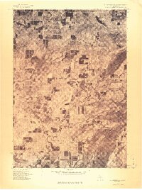
1976 Map of Thompsonville SW
USGS Topo · Published 1976About this map
Thompsonville and its surrounding rural sections are documented in this orthophotoquad, which utilizes aerial imagery from May 1976. The landscape is defined by the winding course of the Betsie River, which cuts through a mosaic of woodlots and agricultural clearings. This photographic record shows the distinct grid of local roads and the clear-cut patterns of land use characteristic of northern Michigan's interior. Small residential clusters like Nessen City and the settlement at Wallin are visible alongside the river, providing a literal view of the built environment and natural tree cover as they existed during the mid-1970s. This advance print offers an unmediated look at property boundaries and riparian vegetation before modern development or reforestation changed the rural character of the area.
Find a feature on this map
4 named features on this map. Tap any name to fly to it.
Don’t see what you’re looking for? This feature index may not catch every label — zoom into the map to look around manually.
Map Details
Editions of this 1976 Thompsonville SW Map
This is the sole edition of this map. No revisions or reprints were ever made.
Other maps of this area

1954 · Traverse City
USGS Topo · 1:250,000

1954 · Manitowoc
USGS Topo · 1:250,000

1956 · Onekama
USGS Topo · 1:62,500

1956 · Thompsonville
USGS Topo · 1:62,500

1956 · Frankfort
USGS Topo · 1:62,500

1957 · Copemish
USGS Topo · 1:62,500

1958 · Traverse City
USGS Topo · 1:250,000

1958 · Manitowoc
USGS Topo · 1:250,000

1976 · Thompsonville NE
USGS Topo · 1:24,000

1976 · Frankfort SE
USGS Topo · 1:24,000