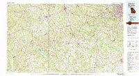
1981 Map of Thomson
USGS Topo · Published 1982About this map
The Fort Gordon Military Reservation occupies a massive expanse in this east Georgia landscape, bordering the growing urban reach of Augusta. To the west, the rural character of the region is defined by a dense network of creek valleys, including Rocky Comfort Creek and the Ogeechee River. Key regional hubs like Thomson, Warrenton, and Waynesboro are linked by the Georgia and Central of Georgia railroads, which historically shaped the commercial development of these counties. Smaller crossroads like Pumpkin Center, Boneville, and Camak are clearly mapped, offering a view of local settlement patterns before modern suburban expansion. Natural features such as Hamburg State Park and the headwaters of Brier Creek provide a look at the preserved recreational and hydraulic geography of the area as it appeared in the early 1980s.
Find a feature on this map
124 named features on this map. Tap any name to fly to it.
Don’t see what you’re looking for? This feature index may not catch every label — zoom into the map to look around manually.
Map Details
Editions of this 1981 Thomson Map
This is the sole edition of this map. No revisions or reprints were ever made.
Other maps of this area

1892 · Mc Cormick
USGS Topo · 1:125,000

1906 · Crawfordville
USGS Topo · 1:125,000

1912 · Milledgeville
USGS Topo · 1:62,500

1912 · Mc Cormick
USGS Topo · 1:125,000

1916 · Irwinton
USGS Topo · 1:62,500

1919 · Gough
USGS Topo · 1:62,500

1920 · Stapleton
USGS Topo · 1:62,500

1920 · Millen
USGS Topo · 1:62,500

1920 · Greens Cut
USGS Topo · 1:62,500

1920 · Irwinton
USGS Topo · 1:62,500