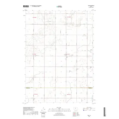
2018 Map of Thor
USGS Topo · Published 2018About this map
The town of Thor serves as the central hub of this agricultural landscape in north-central Iowa, situated just above the Humboldt and Webster County line. The terrain is defined by a sophisticated water management network, including Drainage Ditch Number 40 and Ditch Number 25, which allowed for the cultivation of the fertile prairie lands. This 2018 survey reveals a high density of rural cemeteries that reflect the area's pioneer heritage, such as Willicksen Cem, Norway Lake Cem, and the dual East and West Ullensvang Cemeteries. Natural waterways like Soldier Cr and Beaver Cr meander through the grid of section roads, including County Highway P66 and County Highway C48, which connect the scattered farmsteads and historical burial grounds that dot the landscape.
Find a feature on this map
51 named features on this map. Tap any name to fly to it.
Don’t see what you’re looking for? This feature index may not catch every label — zoom into the map to look around manually.
Map Details
Editions of this 2018 Thor Map
This is the sole edition of this map. No revisions or reprints were ever made.
Other maps of this area

1923 · Fort Dodge
USGS Topo · 1:62,500

1954 · Waterloo
USGS Topo · 1:250,000

1954 · Fort Dodge
USGS Topo · 1:250,000

1955 · Waterloo
USGS Topo · 1:250,000

1957 · Fort Dodge
USGS Topo · 1:250,000

1958 · Fort Dodge
USGS Topo · 1:250,000

1972 · Renwick
USGS Topo · 1:24,000

1972 · Livermore
USGS Topo · 1:24,000
1972 · Hardy
USGS Topo · 1:24,000

1978 · Eagle Grove SW
USGS Topo · 1:24,000